
OUR VISION
The world's finest educators supporting science, technology, engineering, and math (STEM) learning for pre-kindergarten to post-graduate students using real-world applications from satellites and satellite data.
OUR MISSION
To enhance the education environment to excite students about science, technology, engineering, and math through space-based technology -- satellites and satellite data.

Franklin D. Roosevelt

Great discoveries and improvements invariably involve the cooperation of many minds. I may be given credit for having blazed the trail, but when I look at the subsequent developments I feel the credit is due to others rather than to myself.
Alexander Graham Bell

TABLE OF CONTENTS
Click a RED link to view article
Satellites & Education Conference XXXV
John's Journey
Satellites with Ed
In the News
More Lessons
from the Sky
Go to SEA Home Page

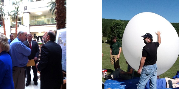
The 35th annual Satellites & Education Conference was held at California State University, Los Angeles and on ZOOM on Friday & Saturday, July 29-30, 2021. The first-time hybrid format this year allowed participation in-person and online for all attendees, keynote speakers, presenters, and exhibitors.
Produced by the Satellite Educators Association, Inc., the conference was hosted by the Charter College of Education at Cal State LA (since 2002), and supported by both NASA and NOAA, the Aerospace Corporation and Raytheon Technologies, as well as the American Institute for Aeronautics and Astronautics and the American Meteorological Society. Presenters and exhibitors delivered content both in-person and on ZOOM, all from Cal State LA's Golden Eagle Ballroom. Registration included breakfast and lunch offerings both Friday and Saturday and full access to our unique Exhibit Hall (also in the Golden Eagle Ballroom).
What is Satellites & Education? So much of what we know about this Earth, our "island home," and our place in it comes from robotic spacecraft with remote sensors orbiting the Earth and traveling to other worlds. The scientific discoveries, the careful engineering, the creative technologies, all employing a mathematical language -- spectacular and awesome advances with additional applications in many other fields of human endeavor. Yet so few teachers and students truly know about them and their importance to life today and in the future. The Satellite Educators Association, Inc. (SEA) was founded in 1989 in response to an overwhelmingly positive turn out for the first Satellites & Education Conference. SEA is a professional organization of educators and those who want to enhance the education environment to excite students about science, technology, engineering and mathematics (STEM) through space-based technology -- satellites and satellite remote-sensing data. SEA was founded by a teacher with a vision. Today, teachers comprise more than half of the Executive Committee and Advisory Board.
The 35th annual Satellites & Education Conference in-person attendees enjoyed a continental breakfast before the conference was officially opened at 9:00 AM Friday morning, July 29, by SEA President Monica Maynard and attendees welcomed by Dr. Cheryl Ney, Dean of Cal State LA's Charter College of Education. The opening keynote address was given by Dave Doody, Senior Systems Engineer at NASA Jet Propulsion Laboratory who spoke of the Europa Clipper and Looking for Signs of Life beyond Earth. SEA was pleased to welcome and feature two high school students, Luke Meier and Ishaan Agrawal, winners of the Northwest Science Expo (Washington, Oregon, Idaho) who presented their Project Nieuwestad: Modeling Exoplanet Habitability with Machine Learning. Six more outstanding presenters, listed below, followed on Friday's schedule. The last session will end about 4:15PM allowing plenty of time to move to the Hilton San Gabriel Hotel for the Annual SEA Banquet and Awards Program at 6:00 PM.
The annual banquet was moved off campus to adhere to Cal State LA's current COVID protocols. Following a delicious dinner of rib-eye steak, salmon, or vegetable pasta, Rhonda Morgan, Senior Optical Scientist at NASA JPL shared insight into the construction of and importance of the first images from the James Webb Space Telescope. If you are unfamiliar with the Webb's multi-faceted, computerized mirror design (partially developed at a NASA sponsored research facility on the Cal State LA campus), the resolution and detail available in the new space telescope's imagery is truly breath-taking and eye-opening. Congratulations to Dr. Morgan and the all members of the NASA team who contributed to this marvelous instrument. Then, Dr. Paula Arvedson, SEA Conference Coordinator, recognized multiple award recipients who have significantly contributed to the conference success over the years.
Back at the Golden Eagle and continental breakfast on Saturday. The schedule for conference day 2 included four informative presenters and a chance to visit each exhibit booth. The closing keynote address was given by Dr. Barbara Shannon, Director of STEM Education for Synergy Academies. Dr. Shannon's energetic presentation challenged each teacher attending in-person and on ZOOM to plan their time and use it wisely to leave no student behind or forgotten. She offered personal methods and examples to accomplish a goal that may seem impossible as so many struggle to adjust to the new reality brought to us by COVID-19. "There is always a way."
You are invited to scroll down to see more about the speakers and the presenters and exhibitors who graciously supported Satellites & Education Conference XXXV.

[ Back to Top ]

Scientists are almost certain a vast ocean lies beneath Europa’s icy shell. NASA's Europa Clipper spacecraft will perform dozens of close flybys of Jupiter’s moon Europa, gathering detailed measurements to investigate whether the moon could have conditions suitable for life. Europa Clipper is not a life detection mission – its main science goal is to determine whether there are places below Europa’s surface that could support life.
Our speaker, Dave, led real-time flight operations (aka “Mission Control”) for the 20-year, multinational Cassini-Huygens Mission in the Saturn system; it ended in 2017. Among Cassini’s many discoveries was that Saturn’s tiny moon Enceladus turned out to be yet another promising ocean world here in our own solar system. Dave will talk about how Europa Clipper will be conducting a thorough reconnaissance of Jupiter’s ocean world Europa, “Merely half as far away, exploring Europa offers its own set of challenges.”
The spacecraft, in orbit around Jupiter, will make nearly 50 flybys of Europa at closest-approach altitudes as low as 16 miles (25 kilometers) above the surface, soaring over a different location during each flyby to scan nearly the entire moon. Europa Clipper will launch in October 2024 and will follow a Mars-Earth Gravity Assist (MEGA) trajectory. The spacecraft will travel for five and half years and arrive at Jupiter in April 2030. The Europa Clipper is NASA’s largest planetary mission spacecraft. With its massive solar arrays and radar antennas, Europa Clipper will be the largest spacecraft NASA has ever developed for a planetary mission. The spacecraft needs large solar arrays to collect enough light for its power needs as it operates in the Jupiter system, which is more than five times as far from the Sun as Earth.
The James Webb Space Telescope (JSWT) is the largest and most complex space telescope NASA has built. The telescope will see the first galaxies forming, will peer through dust to see the birth of planets and stars, and will examine exoplanet atmospheres. The telescope has a 6.5-meter diameter mirror comprised of 18 hexagonal segments and a tennis court size sun shield that keeps the telescope cold at 35 degrees Kelvin. JSWT had 50 major deployments involving the release of 178 pins. The six-month commissioning phase encompassed more than a thousand procedures to align the mirror segments and to verify the 17 instrument modes. The science observations begun in July are a culmination of twenty years of international effort led by NASA. What does it take to achieve this level of optical performance? And how will it be improved by two orders of magnitude for the next 6-meter space telescope that is just starting its twenty-year journey to launch? Extreme optical performance will be required to search for Earth-size exoplanets around nearby stars and to take spectra of those exoplanets to look for biosignatures. The lessons and experience of building JWST move us closer to being able to build a telescope to look for Earth 2.0.
Dr. Morgan earned her MS and PhD in Optical Sciences at the University of Arizona with an emphasis in nulling interferometry for exoplanet direct imaging, and her Bachelor’s in Electrical Engineering from Caltech with an emphasis in remote sensing. She has more than 20 years of experience at JPL, the last seven in the Exoplanet Exploration Program Office as the HabEx large concept study Technologist and as lead of the multi-institutional yield Exoplanet Science-performance Evaluation Team. She has worked extensively with the JPL astrophysics community in various capacities, from proposal work to program and project work, to develop technologies and missions to search for Earth 2.0 and increase our understanding of the universe.
Dr. Shannon holds a BA and MS in Biology and an EdD in Learning and Instruction, Science Education. She recently retired as Director of STEM Education at Synergy Academies. She was the founding principal of Synergy Quantum Academy.
Dr. Shannon spoke with an invigorating enthusiasm for teaching and how to make better use of the resources discovered this at this conference in order to achieve greater results.
[ Back to Top ]
| Project Nieuwestad: Modeling Exoplanet Habitability with Machine Learning Luke Meir, Ishaan Agrawal, High School Students Winners of the Northwest Science Expo (Washington, Oregon, Idaho) |
| As advancements in space exploration and astronomy have increased dramatically in recent decades, looking to humanity’s future in an extraterrestrial or even an extrasolar context is gradually emerging from science fiction into science fact. Additionally, the pervasive question of “are we alone in the universe?” has driven much data collection on observable exoplanets. Thus, the collection, cataloging, and organization of these planets in the context of habitability is an important field of work within astrophysical research. While these are barely even a measurable percentage of what’s out there, impressive thousands of exoplanets have been observed and catalogued. Models and their features in a relevant context present an important question with constantly evolving answers. Our research aims to combine machine learning and exoplanet databases to model the prospective habitability of these observed exoplanets. In our model construction, we trained a machine-learning algorithm to identify the most important features that make a planet habitable and to identify whether or not a planet is habitable. |
| Classroom Activities with the AMSAT Functional CubeSat Simulator Frederic Raab, Educator College of the Desert |
| How to engage students with CubeSat operation and transmission of data to Earth? Raab presented the AMSAT CubeSat Simulator. With the simulator, students are able to manage a satellite’s solar power; determine the satellite’s orbital period, orientation, and spin rates; expand mission payloads; utilize radio protocols; and more. The Radio Amateur Corporation (AMSAT) is a non-profit educational organization founded in 1969. For more than 50 years, AMSAT has placed satellites in low Earth orbit enabling voice communications between amateur radio operators. Since 2015, four of those have been CubeSats, and the AMSAT radio designs and protocols for those CubeSats have been adopted by numerous educational CubeSats currently in orbit. AMSAT developed the CubeSat Simulator to provide students with hands-on, classroom experience receiving and interpreting operational telemetry data using the same radio communications methods employed by CubeSats. AMSAT makes simulators and ground stations available for loan to teachers and other educational groups accompanied by instructions for classroom activities. The ground station software enables students to hear, visually observe, and decode many of the radio formats in use today for data exchange, reporting position, and image reception. The station is built around the popular Raspberry Pi single-board computer attached to a small screen displaying data transmitted by an active orbiting AMSAT satellite or the CubeSat Simulator. |
| Overview of the NASA TechRise Student Challenge Lucas Moxey, Project Manager NASA TechRise |
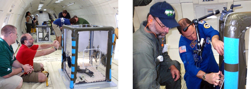
| Moxey presented an overview of the NASA TechRise Student Challenge, sponsored by NASA’s Flight Opportunities Program. This challenge invites teams of 6th to 12th grade students throughout the United States and its territories to engage in hands-on science, technology, engineering, and math (STEM) opportunities. The program empowers students to propose experiment ideas that leverage the use of electronics and microcontrollers, and it offers winning teams an opportunity to fly those experiments on a suborbital flight platform, with the goal of testing their experiments in near-space and/or microgravity (i.e., weightlessness) conditions. As part of the TechRise 2021-2023 challenge, a total of 57 student teams were selected from across the nation to participate. Each winning team was awarded a $1,500 prize, a customized flight hardware enclosure, engineering and buildup support, as well as a flight test on either a high-altitude balloon or a rocket-powered suborbital vehicle. The current student experiments span a wide variety of technology areas and applications. |
| NGSS + Satellite Imagery + Motivation = Success Ed Murashie, President ProEngineered Solutions |
| Satellite imagery can be the tool to implement the Next Generation Science Standards in kindergarten through high school. But how do you learn about satellite imagery and where can you find it? This presentation, of course! Murashie showed us how to learn about satellites with hands-on demonstrations using live satellite reception. Particpants walked away with lesson plans and other online references. |
| CubSat Mission: Human Impacts on the Planet Monica Maynard, STEM Coordinator, Aerospace Corp, California |
| Maynard demonstrated a two-part lesson plan in which students research human impacts on the planet and design a CubeSat to monitor a specific example. Throughout the project, key skills including critical thinking, communication, and collaboration were used to understand the true value of data from space. |
| Earth SySTEM: Using Satellites to Monitor the Earth John Moore, Executive Director Institute for Earth Observations, New Jersey |
| The A3Sat Project allows students to build an active model mirroring many aspects of an authentic CubeSat design engineers use for launch into space. A3Sat has been programmed to send data and imagery to a designed ground station replicating collection and transmission of data. The app is a desktop software application, compatible with both macOS and Windows, and is able to communicate and transfer various data through Python socket communication. Students are able to pair the A3Sat and the computer through a WIFI hotspot from the Raspberry Pi, and further control the A3Sat from the app while also viewing real-time environmental data, health data (CPU intensity, etc.), as well as infrared and regular images. Built within the Group Station app are data analysis and visualization tools, such as data plotting of all environmental data, as well as a 3D graph visualization of the altitude/displacement of the A3Sat. Students are able to conduct data analysis while the A3Sat is still in flight, viewing data stream into the app while also being plotted live within. |
| Learning Math Through the People Who Lived It Robert Black, Author |
| Author and engineer Robert Black returned to the Satellites & Education Conference with his newly-completed biography series for teens, The Mathematical Lives. Developed over the past five years, the six volumes introduce readers to some of history's most important mathematicians and the problems they worked on. Each book even gives readers the chance to work the actual historical problems themselves. In this presentation, author Robert Black revealed the themes behind the series, exploring how our understanding of math has changed, and how that understanding has changed us. He also recounted how the Satellites & Education Conference helped with the development of the series, and of his mathematically-themed writing in general. |
| Earth Station Lab: An Educational Coimputer Application Using Satellite Remote-Sensing Data Steve Mills, Director PolymathGeo |
| Earth Station Lab (ESLab) is a web-based application that has been developed by Polymath Geo (PG) and the CSUN Center for Geospatial Science and Technology (CGST). It is intended as a lab component of Earth science curricula. It links Geographic Information Systems (GIS) and Virtual Learning Environment (VLE) software, and uses government produced satellite remote sensing data as a part of Project-Based Learning curricula. The VLE has separate interfaces for students and teachers. ESLab uses the WISE VLE application developed with NSF funds at UC Berkeley. Satellites produce vast quantities of data made available to the public, but the volume of the data and the complexity of GIS makes it difficult for teachers and students to use within a classroom setting. ESLab simplifies this process so that this technology can be a part of any classroom. In 2021, PG and CGST developed a simple to use data conduit application that connects with the big satellite databases of NASA, NOAA, and other federal agencies and converts these data into slippy maps compatible with OpenLayers. Called Earth Station Link (ESLink), it is designed to allow teachers to download local and timely data that is relevant to their own lesson units. ESLink ensures that teachers do not need to complete an exhaustive search of the agency portals or convert the data into a usable format on their own. As part of this presentation, ESLab and ESLink were demonstrated including a high school lesson unit on the ENSO. |
| Mapping Mars Dominique Evans-Bye, Educator Clark Magnet High School |
| Students at any level can enjoy exploring Mars and mapping its topography. This presentation introduced Mars viewers from NASA, fun activities to hook students' attention, and mapping activities using ArcGIS Online, JMARS and ArcGIS Pro. A story map was shared that has links and instructions to complete each of the activities presented. Mapping Mars is part of a quarter unit of GIS & Remote Sensing at Clark Magnet High School. It is an extension of the Mars Student Imaging Project developed by Arizona State University (http://marsed.asu.edu/msip). |
| Making Math Accessible Joan Horvath and Rich Cameron, Co-Founders Nonscriptum |
| 3D printing is a natural fit to teaching many subjects, most notably math, engineering and other STEM subjects. Horvath and Cameron are the authors of many popular books about 3D printing and its classroom applications, including MAKE: Geometry and the upcoming MAKE: Calculus. They have also developed geometry curriculum modules for teachers of visually impaired students. Join them to hear about the opportunities and barriers for 3D printing for students in K-12, universities, and special education. |
[ Back to Top ]
By Pete Arvedson, SEA Web manager
Since 1988, this conference's unique Exhibit Hall has showcased organizations and vendors bringing you services and materials supporting students and teachers. The hybrid format of the 2022 conference means some exhibitors were in-person at booths and tables in the Exhibit Hall while others were be spotlighted on ZOOM periodically throughout the conference.
You are invited to join me for a walk around the Golden Eagle Ballroom as I visit each exhibitor. To orient ourselves, the central area of the ballroom has well-spaced tables and chairs for in-person attendance at each presentation. The "exhibit hall" is arranged around the perimeter of the ballroom. The speaker's podium is in the front of the ballroom. We will start our walk nearest the podium and travel counter-clockwise around the exhibit hall.
Here we find our good friend, and SEA member, Bob Black with an impressive display of his mathematically-themed books including the latest biographical series for teens, The Mathematical Lives. Bob's writing focuses on the important contribution of each book's subject presented in such a way that even the most "math-shy" are enticed toward understanding. His award-winning books are well-researched, well-written, and engaging reads.
This non-profit organization was established in 1989 as a professional society to promote the innovative use of satellite technology in education and disseminate information internationally to all members. It is the driving force behind more than three decades of Satellites & Education Conferences. Staffing the booth is my close friend and long-time colleague Duane Laursen, retired high school science teacher and SEA life member. Duane offers a wide selection of handouts resources and demonstration access to the Association's Web site, SatEd.org. He is always ready to talk with visitors and offer helpful ideas where he can.
AIAA has been an integral supporter of the Satellites & Education Conference since the early 1990s when the conference was held in Pennsylvania. Today, members of this local section, especially Ken Lui (independent consultant), Sheri Stukes (software systems engineer, JPL), and Jeff Puschell (Raytheon Technologies; SEA Vice-President) provide unparalleled support in producing this conference. Ken and Sheri staff the the booth offering the most intriguing variety of "toys" that demonstrate and teach engineering concepts in addition to many educational resources. Both are ready to talk with visitors about all that AIAA has to offer teachers.
NASA Jet Propulsion Laboratory, managed by California Institute of Technology, is NASA's lead center for robotic exploration of the solar system. Long-time friend and SEA life member Annie Richardson welcomes us to the NASA booth. For many years, Annie, an Education Outreach Specialist at JPL, arranged magnificent tours of JPL for the M.Y. S.P.A.C.E. Teams with with opportunities to meet and hear presentations from scientists whose areas informed the annual M.Y S.P.A.C.E. research theme. Friendly, outgoing, and supportive, Annie is assisted this year by Erica Carcelen and Adriana Le Compte as SEA also welcomes NASA DEVELOP to the Satellites & Education Conference.
Several years ago, Linda Sciaroni, teacher at Firebaugh High School in Lynwood, California, engaged Educational Passages to help her students build a 7-foot sail boat. The boat, dubbed "Fledgling Freddy," was equipped with two tracking systems, camera, temperature sensors, GPS, and tilt meters. The boat has been "sailing" in the Pacific Gyre (aka "the garbage patch") for more than 250 days sending regular data from its remote sensors. Linda showed us maps of the boat's journey and discussed the project and findings thus far.
Here we find Steve La Dochy, Cal State LA Professor Emeritus from the College of Natural and Social Sciences. Steve, too, is a long-time supporter of the Satellites & Education Conference and once served as SEA Membership Chair. He is active in the local AMS chapter and brings a variety of resource links and printed materials for visitors to glean and utilize. Steve offered me a book on meteorology, sort of a beginner's volume, published by AMS Project Atmosphere. This small volume is so comprehensive, yet so very clearly written, I wished I had a class set for my high school students before I retired. AMS offers so many educational resources and training opportunities for teachers, and Steve is always ready to help where he can.
Monica Maynard is a remarkable and busy teacher, and SEA life member. Yet she finds time to serve as SEA President and as the STEM Coordinator for The Aerospace Corporation. With a friendly smile, Monica tells us of the long-standing Aerospace commitment to education. She offers access for both teachers and high school students to events, research, facilities, and resources providing real-world examples of problems and solutions. Through Monica, the Satellites & Education Conferences have benefited from the expertise of numerous, informative and interesting speakers.
Our last stop around the exhibit hall is Nonscriptum where Joan Horvath and Rich Cameron offer visitors a quick look at one of the most innovative and helpful set of tools for teaching math. Joan and Rich used 3D printing to design and build hands-on working and static models of mathematical functions and concepts. These visual and tactile tools bring alive what might otherwise seem difficult math to some. Applicable to literally all students, these devices are clearly explained in a series of how-to books. All you need is access to a 3D printer and imagination.
That's the Satellites & Education Conference Exhibit Hall this year. Thank you for joining me on this walk around to meet these extraordinary and inventive people.
SEA is grateful to all the supporting exhibitors for sharing themselves with you during Satellites & Education Conference XXXV. Our exhibitors would love to hear from you with questions and requests for more information. Their contact information can be found in the Conference Program.
[ Back to Top ]


By Ron Gird, Meteorologist and former Satellite/Spaceflight and Outreach Program Manager for the National Weather Service
Hi Folks.
NOAA Research News released this article on August 24 announcing the result of the latest annual analysis of air samples from around the globe -- the concentration of stratospheric ozone appears to be returning to 1980 levels. This significant milestone could only happen by listening to reason and exercising honest global cooperation. I can't help but wonder what it would take to set the Earth's inhabitants on a similar path to recovery from more recent climate change concerns. Enjoy the news from NOAA. -Ron
From NOAA Research News at https://research.noaa.gov/article/ArtMID/587/ArticleID/2900/Path-to-recovery-of-ozone-layer-passes-a-significant-milestone
.png)
An annual analysis of air samples collected at remote sites around the globe that is tracking a continued decline in the atmospheric concentration of ozone-depleting substances shows the threat to the ozone layer receding below a significant milestone in 2022, NOAA scientists have announced.
In early 2022, the overall concentration of ozone-depleting substances in the mid-latitude stratosphere had fallen just over 50 percent back to levels observed in 1980, before ozone depletion was significant. This slow but steady progress over the past three decades was achieved by international compliance with controls on production and trade of ozone-depleting substances in the Montreal Protocol on Substances that Deplete the Ozone Layer.
The pace of reduction in ozone-depleting substances (ODSs) over Antarctica, which experiences a large ozone hole in spring, has been slower, NOAA’s analysis showed.
"It’s great to see this progress," said Stephen Montzka, senior scientist for NOAA’s Global Monitoring Laboratory. "At the same time, it’s a bit humbling to realize that science is still a long way from being able to claim that the issue of ozone depletion is behind us."
[ Back to Top ]


By John D. Moore, Executive Director, Institute for Earth Observations at Palmyra Cove, New Jersey
As I begin this month’s John’s Journey, let me first thank the SEA leadership for the great honor of being chosen the recipient of the 2022 Vic Everett Memorial Service Award. As I mentioned at the Conference, it was Vic who designated my newsletter contribution as John’s Journey. When he suggested that title, I asked him how he came up with it. He said, "Because you’re always writing about what’s going on in your professional life and travels." I reflected on that for a moment and told him it was pretty much true -- and I liked the title. The rest, as they say, is history. Besides being SEA’s official photographer at the annual Satellites & Education Conference, Vic worked very quietly in the background to make sure nothing fell through the cracks. So, to receive an award in memory of his service to SEA is indeed an honor.
I was delighted to see that there were several presentations at this year’s conference on CubeSats. As I continue to research and track the evolution of CubeSats and their ever-increasing contributions to the aerospace enterprise, it causes me to reflect on early conversations and technological developments in the first Satellites & Education Conferences. Understanding the fundamentals, developing hardware, then software, then lessons, all working towards the goals of impacting education from the local to national level, and providing students with a vision for their future and how to navigate a pathway towards those goals. The applications of satellites and remote sensing in the early days of SEA, and now the trends in using CubeSats, require having a visionary quality. As applications are developed in real time, they are indeed an "emerging technology." In terms of Career and Technical Education, we are preparing students for careers that do not yet exist. When the applications do emerge, we will be ready. It is important to note that many of these careers will be of a technical nature and therefore may require a different pathway other than college/university.
In 2010-11 Kevin Simmons and I were Einstein Fellows serving at the National Science Foundation. In those early days, the NSF Directorate for Geosciences was a primary funder of CubeSat Missions/Research especially focused on the Upper Atmosphere. Working together, we built a case for using CubeSats in education -- pre-college education. Upon returning home to New Jersey, I met Dr. Jin Kang of Drexel University. He not only was building a CubeSat for launch, but shared our vision for using CubeSats as a disruptive technology to be used by pre-college education, preparing students for university study and providing workforce readiness skills.

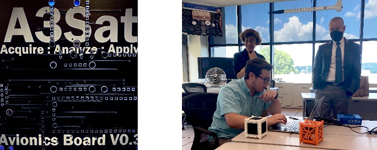
The A3Sat Emulator V 1.0 was designed to authentically replicate building a CubeSat for pre-college students. Using a Raspberry Pi, the "Enviro +" sensor, and cameras, created a platform for students to practice authentic engineering and design, coding, and skills focused on monitoring and collecting geoscience imagery and data. It was designed to fly on a drone, balloon, or NASA Aerokat kite. It was developed and vetted as a "Tier 1" emulator, i.e. introducing students to CubeSats, their major components, and hands-on experience with electronics skills and coding. A3Sat’s development was vetted by both Professor Bob Twiggs (Co-Founder of CubeSats), and Dr. Jin Kang (US Naval Academy). There were plans to move towards a "Tier 2" in the Summer of 2022. Tier 2 moves the emulator closer to a space ready experience and construction. Due essentially to the current unavailability of the Raspberry Pi, our work on Tier 2 accelerated.
Tier 2 work required the design and development of the following features:
The A3Sat Team visited the U.S. Naval Academy (USNA) Satellite Lab on August 18, 2022. After touring the Naval Academy, we visited Dr. Kang and toured the Satellite Laboratory. Dr. Kang explained the steps and processes on building and launching a CubeSat into space including preflight testing. For example, the routine known as "Shake and Bake" tests the satellite’s ability to transition into a space environment and not self-destruct during the stress of launch. In the lab we presented our new boards to Dr. Kang’s colleagues. A plan is afoot to incorporate the A3Sat Emulator in the USNA Satellite Lab activities.
We are looking for STEM students who have interest and skills in areas such as electronics, coding, and/or programming to join the team. Of particular interest are those students who are seeking STEM Leadership experiences. One of the few benefits of the COVID season is that we have learned to work together remotely.
Arguably the most limiting factors to using CubeSats in pre-college education has been funding and payload launch. Since its early days, the Satellite Educators Association set the example for working collaboratively with government, industry, and education communities in support of teachers and to address funding issues. In more recent times, evolving launch companies have made launch opportunities less an impediment. Now, I believe we have reached another milestone. Therefore, the question is, "What’s next?" My journey will take me to Kennedy Space Center in late October 2022.
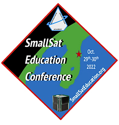
The Inaugural SmallSat Education Conference "serves as an important East Coast gathering where educators, administrators, and students learn about CubeSats, ThinSats, and High-Altitude Balloon programs." This gathering "will provide hands-on opportunities for educators and students of all ages to learn how they may "Go To Space." This event is managed by the Aerospace and Innovation Academy, the Wolfpack CubeSat Development Team, and BLUECUBE Aerospace. The target audiences are faculty and students from middle school through college on 29-30 October 2022 at the Center for Space Education Building, Kennedy Space Center Visitors Center, Florida. For more information go to https://www.smallsateducation.org/.
Artemis 1 marks a new chapter in space exploration has we embark on the return to the Moon, building a new space station, and heading towards Mars. Artemis is going to Space with CubeSats, ten (10) of them! The Orion spacecraft will separate from the SLS upper stage about two hours after liftoff and the CubeSats will separate over the next couple of hours. Payloads range from infrared spectrophotometers to re-hydrating microorganisms, to mapping the South Pole of the Moon, to testing a plasma propulsion system in deep space, plus others. SpaceX has already launched student payloads, as well as Blue Horizon.
Students will experience a robust future through both exciting and challenging adventures in space and no longer have to wait for graduate school to begin. They are here NOW! The STEM community is ready NOW. Is education?
Remember - "you can teach anything with satellites."
Stay safe - stay well!
For now, I'm John...and this is my journey.
[ Back to Top ]


By Edward Murashie, President, ProEngineered Solutions
Thunder storms, tropical storm and volcanos make for some of the more visually stunning weather satellite images, but the most impressive are major hurricanes. For comparison, the largest tornado on record was 2.5 miles wide with wind speeds up to 296 mph while 2022 Hurricane Darby reached 140 mph sustained winds with hurricane force winds 20 miles wide. Below is a GOES-16 satellite image of Hurricane Darby near its peak, received on July 11 using my home ground station. Because HRIT ground stations can be simple and inexpensive, they are suitable for the classroom.
Since we are over half way through this hurricane season, now is a good time to get an update.
As reported in the June SEA Newsletter, the National Weather Service Climate Prediction Center predicted a below-normal hurricane season. However the actual data to-date shows the numbers may be exceeded.
| Season Prediction | Actual Thru Sep 1 | |
| Named Storms | 10-17 | 91 |
| Hurricanes | 4-8 | 7 |
| Major Hurricanes | 0-3 | 2 |
A hurricane has maximum sustained winds of 74 mph to 110 mph and is rated category 1 or 2, while a major hurricane is 111 mph or greater and is rated category 3, 4, or 5 depending on the range of wind speeds. The season runs from May 15 through November 30.
Through the end of August 2022, here are the named storms courtesy NOAA/NWS:
| Name | Type / Category | Dates | Max Winds (mph) |
| Agatha | H / 2 | May 28-31 | 110 |
| Bias | H / 1 | Jun 14-20 | 90 |
| Celia | TS | Jun 16-28 | 65 |
| Bonnie | MH / 3 | Jul 1-9 | 115 |
| Darby | MH / 4 | Jul 9-16 | 140 |
| Estelle | H / 1 | Jul 15-21 | 85 |
| Frank | H / 1 | Jul 26-Aug 2 | 90 |
| Georgette | TS | Jul 27-Aug 3 | 60 |
| Howard | H / 1 | Aug 6-11 | 85 |
| Ivette | TS | Aug 13-16 | 40 |
Source: https://www.nhc.noaa.gov/text/MIATWSEP.shtml
The National Weather Service Climate Prediction Center predicted an above-normal hurricane season. The actual data to-date tells a different story and let’s hope that remains the case. In fact it is the first time in 25 years that there were no name storms in the month of August.
| Season Prediction | Actual Thru Sep 1 | |
| Named Storms | 14-21 | 3 |
| Hurricanes | 6-10 | 0 |
| Major Hurricanes | 3-6 | 0 |
Unlike the Eastern Pacific hurricane season, the Atlantic season runs June 1 through November 30. Through the end of August 2022, here are the named storms:
| Name | Type | Dates | Max Winds (mph) | |
| Alex | TS | Jun 5-6 | 70 | |
| Bonnie | TS | Jul 1-2 | 50 | |
| Colin | TS | Jul 2-3 | 40 |
Source: https://www.nhc.noaa.gov/text/MIATWSAT.shtml
Shown below is a GOES-16 satellite image received on September 3 on my home station. The image shows four new storms which have formed since September 1. Tropical Storm Javier is to the west of central Baja and Tropical Storm Kay is located south of Baja, both in the eastern Pacific region. Hurricane Danielle, with its well-formed eye, is well east of Long Island New York, and Tropical Storm Earl is located north of the Dominica Republic, both in the Atlantic region.
Until you have your own weather satellite ground station, you can view the latest storm images online.
The hurricane image above was taken by the GOES-16 weather satellite. GOES stands for Geostationary Operational Environmental Satellite which tells you a little about its orbit. Because the satellite orbits the Earth at the equator at the same rate as the Earth rotates, the satellite "appears" fixed over one spot on Earth making it ideal for tracking storms.
There are other weather satellites called polar satellites because their orbits takes them near the north and south poles. One such satellite is the JPSS-1 satellite. The rocket components and satellite needed to launch JPSS-2 on November 1 are coming together at Vandenberg Space Force Base located on the California coast. We will cover that satellite’s mission in the next newsletter.
As always if you have questions or comments, please email me at eamurashie at gmail dot com.
[ Back to Top ]


By Andrew Dunne, Horizon: The EU Research & Innovation Magazine
August 12, 2022
From phys.org at https://phys.org/news/2022-08-nature-weather-coastal-storms.html

Extreme weather events are becoming more frequent and intense, sometimes with tragic consequences. Europe's coastal cities are preparing to meet the challenges with help from nature and data from outer space.
As the people of La Faute-Sur-Mer—a small French coastal town in the Vendée north of La Rochelle—tucked into bed on the night of 27 February 2010, a violent storm was raging out at sea.
Swirling, cyclonic winds, high waves and heavy rain blown up across the Bay of Biscay combined with a high spring tide to wreak havoc as it battered the coastline of western France. Residents awoke to a scene of utter devastation.
Perched perilously between the Atlantic Ocean on one side and the river Lay on the other, the town was completely inundated by flooding from the storm surge. Homes, property and businesses were ruined.
Of the 53 people in France who died as a result of Storm Xynthia, 29 were from La Faute.
In a town with a population of just 1,000 people, it was a devastating tragedy.
Such extreme weather events are becoming more common and seaside regions are particularly vulnerable, says Dr. Clara Armaroli, a coastal geomorphologist who specializes in coastal dynamics (how coastlines evolve).
In response, the University School for Advanced Studies (IUSS) in Pavia, Italy, is leading a pan-European project to develop an early-warning system to increase coastal resilience. Armaroli coordinates the project, called the European Copernicus Coastal Flood Awareness System (ECFAS).
[ Back to Top ]
August 4, 2022
From NOAA National Environmental Satellite Data and Information Service News & Events at https://www.nesdis.noaa.gov/news/kentucky-and-missouri-devastated-flash-flooding
Hundreds of miles apart, but connected by the same weather system, urban St. Louis and rural Appalachia have experienced devastating flash flooding.
At least 37 people have been confirmed dead in Kentucky, Gov. Andy Beshear said Monday afternoon, and the death toll will continue to rise as the flood waters and debris recedes.
Gov. Beshear described "widespread damage" that displaced thousands of people, including power outages for thousands as well as washed-out roads, destroyed homes, and flooded schools. More than 600 people have been rescued by aircraft and boat since the flooding began, Beshear said.
President Joe Biden approved funding to support disaster relief efforts in Kentucky amid the deadly flooding. Biden declared a major disaster in Kentucky Friday morning and directed federal aid for recovery efforts in the state.
[ Back to Top ]
September 9, 2022
From NASA Science at https://science.nasa.gov/earth-science/earth-information-center
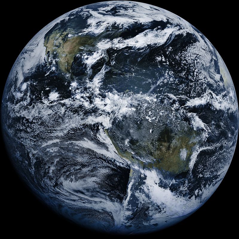
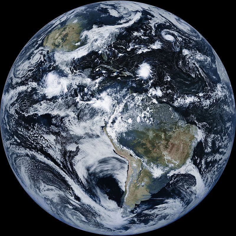
For more than 50 years, NASA satellites have provided open-source and publicly available data on Earth’s land, water, temperature, weather, and climate.
To improve access to this key information, NASA Administrator Bill Nelson announced a concept for the Earth Information Center in October 2021, and released the first concept in September 2022, which will allow users to see how our planet is changing and provide easy-to-use information and resources that support decision makers in developing the tools they need to mitigate, adapt and respond to climate change.
[ Back to Top ]
From NASA Earth Observatory at https://earthobservatory.nasa.gov/images/150111/lake-mead-keeps-dropping
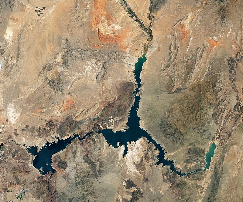
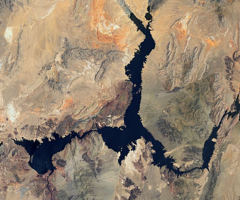
Continuing a 22-year downward trend, water levels in Lake Mead stand at their lowest since April 1937, when the reservoir was still being filled for the first time. As of July 18, 2022, Lake Mead was filled to just 27 percent of capacity.
The largest reservoir in the United States supplies water to millions of people across seven states, tribal lands, and northern Mexico. It now also provides a stark illustration of climate change and a long-term drought that may be the worst in the U.S. West in 12 centuries.
The low water level comes at time when 74 percent of nine Western states face some level of drought; 35 percent of the area is in extreme or exceptional drought. In Colorado, location of the headwaters of the Colorado River, 83 percent of the state is now in drought, and the snowpack from last winter was below average in many places.
The natural-color images above were acquired on July 6, 2000, and July 3, 2022, by Landsat 7 and Landsat 8. The detailed images below also include a view from Landsat 8 on July 8, 2021 (middle). The light-colored fringes along the shorelines in 2021 and 2022 are mineralized areas of the lakeshore that were formerly underwater when the reservoir was filled closer to capacity. The phenomenon is often referred to as a "bathtub ring."
[ Back to Top ]


Use satellite technology to determine the different cloud types that are seen from a satellite in space. Compare to your own digital photos of clouds taken from ground level. Characterize cloud patterns locally and globally with associated changes in weather conditions. Forecast local weather based on your cloud observations.
| Grade Level: | 5-12 |
| Time Requirement: | Varies from 2 class periods to a school year |
| Prerequisites: | None |
| Relevant Disciplines: | All |
[ Back to Top ]
Share your satellite-based lesson ideas with the teaching community.
Send us a full lesson plan, or simply suggest a lesson idea. If you found the idea online, please share the source as well. The lesson can be about anything that helps connect learners with satellite-based technology - any grade level K-12 - any STEM subject area or geography.
"Satellite-technology" includes any part of the science, math, engineering, or technology of satellites, rockets, and remote sensing instruments as well as the use of any environmental satellite data to explore questions related to aspects of global change and local impacts in the long term, short term, and catastrophic time frames. Of special interest are lessons providing opportunities for learners to inquire, experiment, and apply mathematics.
Perhaps you designed a lesson yourself - we will happily prepare it for future publication in More Lessons from the Sky and inclusion in the SEA Lesson Plan Library. Perhaps you found a worthy lesson plan published elsewhere - we can research it inclusion in a lesson plan spotlight. In either case, you will receive full credit for developing and/or bringing the lesson to the attention of the teaching community. Don't forget to share your insights if you tried the lesson with students.
Please share your ideas at SEA.Lessons@SatEd.org.
[ Back to Top ]
![]()

This edition of the SEA Newsletter was produced in HTML5.
It is best viewed with most recent updates of Firefox, Edge, Chrome, Opera, or Safari.
©Satellite Educators Association, Inc. https://SatEd.org SEA.Newsletter@SatEd.org
Satellite Educators Association, Inc. is a 501(c)(3) non-profit educational organization.
The SEA Newsletter is published on-line monthly except January and August and available at no cost.
SEA terms, conditions, policies, and contact information are detailed HERE.
Unless otherwise listed, all photo and image credits are the authors of the articles.
Any opinons expressed in this Newsletter are those of the authors
and not necessarily those of the Satellite Educators Association, Inc.
or any of its officers, members, or representatives.
Many SEA Newsletter items contain third-party links to sites not governed by Satellite
Educators Association, Inc. The viewer is cautioned to be aware of the terms of use and
privacy policies for those third-party sites.
![]()