
OUR VISION
The world's finest educators supporting science, technology, engineering, and math (STEM) learning for pre-kindergarten to post-graduate students using real-world applications from satellites and satellite data.
OUR MISSION
To enhance the education environment to excite students about science, technology, engineering, and math through space-based technology -- satellites and satellite data.

George Jean Nathan

Now more than ever the people are responsible for the character of their Congress. If that body be ignorant, reckless, and corrupt, it is because the people tolerate ignorance, recklessness, and corruption.
James A. Garfield

TABLE OF CONTENTS
Click a RED link to view article
Association News
John's Journey
In the News
For Teachers
More Lessons
from the Sky

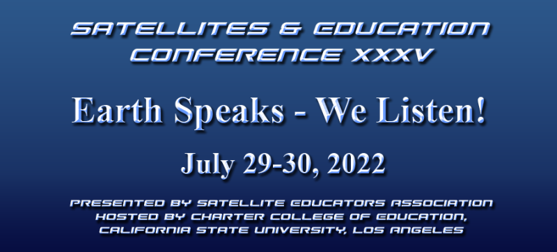
Have you ever wished you could revisit a conference session, speech, meeting with a significant speaker, or class lecture to check your notes or listen and see that singular comment one more time for clarity? Perhaps you missed that presentation and wish there was some way to turn back the clock and try again. For Satellites & Education Conference XXXV held July 29-30 at California State University, Los Angeles, the wait is over. Just visit https://SatEd.org/conferences/ and select 2022 Conference Highlights.
...all freely available at https://SatEd.org/conferences/, compliments of the Satellite Educators Association.

[ Back to Top ]


By Ron Gird, Meteorologist and former Satellite/Spaceflight and Outreach Program Manager for the National Weather Service
Hi Folks.
Each new generation of polar-orbiting and geostationary weather satellites carries newer technological improvements in the type and quality of remote sensors carried by those satellites. Each generation of improvements extends our understanding of weather and climate and allows better models and forecasting. The obvious advantage to longer-range forecasting with greater accuracy is the increased potential for saving life and property through planning and preparation prior to a catastrophic storm or other disaster. NOAA recently announced a new mapping tool that utilizes census data. The tool will aid our understanding of the weather at the community level. Enjoy! -Ron
From NOAA Research News at https://www.noaa.gov/news-release/noaa-tool-now-brings-disaster-risk-vulnerability-down-to-community-level
A comprehensive update to NOAA’s Billion Dollar Disasters mapping tool now includes U.S. census tract data – providing many users with local community-level awareness of hazard risk, exposure and vulnerability across more than 100 combinations of weather and climate hazards.
The enhanced interactive maps from NOAA’s National Centers for Environmental Information (NCEI) cover all 50 states and the District of Columbia, and provide data for over 72,000 U.S. census tracts, which are small subdivisions of counties that average about 4,000 inhabitants. Users can now visualize a community’s combined physical exposure, socioeconomic vulnerability and markers of resilience to natural hazards on a finer scale than ever before.
“The updated tool will provide a better understanding of how weather, ocean, and climate disasters impact many Americans at the community level, and help guide targeted preparation and mitigation efforts as we build a Climate-Ready Nation,” said NOAA Administrator Rick Spinrad, Ph.D. “This hyper-local information advances NOAA's vision for resilient communities and economies, and will strengthen our support for vulnerable populations that face outsized weather, ocean and climate risks.”
[ Back to Top ]


By John D. Moore, Executive Director, Institute for Earth Observations at Palmyra Cove, New Jersey
"Where Discoveries Begin" is the byline found on the Nation Science Foundation’s (NSF) Web site. Entities such as the U.S. Congress, National Academies of Science, NASA, NOAA, Office of Science and Technology (OSTP), and the White House (not listed in any particular order of importance) all have a stake in the NSF. These groups represent how and what science and science policy take place in the United States.
I was fortunate to work with people from all of these agencies during my two years at the NSF in the Directorate for Geosciences. From that perspective I found them to be remarkably interconnected where some offered directives leading to policy, some provided research, some dealt with funding, or any combination of those. Then there was the worldwide review system developed by the NSF that tended to categorize a proposal’s focus as either Intellectual Merit or Broadening Participation. As an Einstein Fellow, I was privileged to help organize, sit in on, and sometimes lead discussions in groups of those designated Principal Investigator. It was interesting to see a wide range of opinions on the importance of Broadening Participation at that time even though NSF policy equates the two with equal weighting in the review process. As I reflect on those two years, I must remember it was 2009-2011 – some things may have changed over the last decade.
In 2010, policy statements and programs continued to emerge that promoted and guided STEM education with national importance. You may remember a very powerful report from the President’s Council of Advisors on Science and Technology (PCAST) to then President Obama, Prepare and Inspire: K-12 Education in Science, Technology, Engineering, and Mathematics for America’s Future. This document set a strong agenda with clearly identified recommendations. The opening of the document’s Executive Report states, “STEM education will determine whether the United States will remain a leader among nations and whether we will be able to solve immense challenges in such areas as energy, health, environmental protection, and national security. It will help produce the capable and flexible workforce needed to compete in a global marketplace. It will ensure our society continues to make fundamental discoveries and to advance our understanding of ourselves, our planet, and the universe. It will generate the scientists, technologists, engineers, and mathematicians who will create the new ideas, new products, and entirely new industries of the 21st century. It will provide the technical skills and quantitative literacy needed for individuals to earn livable wages and make better decisions for themselves, their families, and their communities. And it will strengthen our democracy by preparing all citizens to make informed choices in an increasingly technological world.” The importance of continued STEM leadership in the United States has global significance.

Fast forward twelve years to 2022. A recent report from the National Academy of Sciences (NAS), Protecting U.S. Technological Advantage, states, “U.S. leadership in technology innovation is central to our nation’s interests, including its security, economic prosperity, and quality of life. Our nation has created a science and technology ecosystem that fosters innovation, risk taking, and the discovery of new ideas that lead to new technologies through robust collaborations across and within academia, industry, and government, and our research and development enterprise has attracted the best and brightest scientists, engineers, and entrepreneurs from around the world [emphasis added]. The quality and openness of our research enterprise have been the basis of our global leadership in technological innovation, which has brought enormous advantages to our national interests.” (National Academies of Sciences, Engineering, and Medicine. 2022. Protecting U.S. Technological Advantage. Washington, DC: The National Academies Press. https://doi.org/10.17226/26647). It seems that the Intellectual Merit community remains on the same page.
What about Broadening Participation? Considerable attention has been focused on underrepresented groups and/or Diversity, Equity, and Inclusion in recent years. Many if not all agencies solicited proposals addressing these issues. This is not a new trend. In response to an NSF bulletin entitled Development of Programs to Increase Diversity in the Geosciences (AD/GEO Bulletin No. 00-22, May 25, 2000), the Directorate for Geosciences (GEO) developed the Network for Diversity and Education for implementation in fiscal year 2001. This initiative emphasized broadening participation in the geosciences by “traditionally underrepresented groups including women, minorities and persons with disabilities.”
For the record, literally millions of dollars have been allocated to fund these programs since 2000. Targeted solicitations were offered under a separate, specific heading in NSF Geoscience Education called Opportunities for Enhancing Diversity in the Geosciences (OEDG). The point is, there has been considerable work for over two decades in addressing Broadening Participation…perhaps not enough, one may argue, but the reality is both categories are being addressed.
Now, if you will, reflect with me on the past year for a look at the emerging New Space Ecosystem. NASA is poised to launch Artemis taking a huge step forward in a return to the Moon and the accomplishments of SpaceX continue to push the upper limits. We are witnessing, in our time, government and private industry working together for common goals, and new technologies such as CubeSats are being infused into the Space Ecosystem. With plans to return to the Moon, build a new Space Station, and land humans on Mars, among many planned future projects, it is critical to keep innovation in the forefront. A study for NASA by the NAS (NAS 2022, Advancing Diversity, Equity, Inclusion, and Accessibility in the Leadership of Competed Space Missions) examines the full pathway into careers in earth and space sciences to identify opportunities for diversifying the pool of potential proposal leadership teams, in particular those staring with decisions by young people to engage with science and consider careers in science, technology, engineering and mathematics (STEM).
This, too, is not new to us as it relates directly to, and supports the work of, SEA for thirty-five years.
As you may recall, the objectives of the A3Sat Project are to build an “affordable” emulator, and develop STEM skillsets for the purpose of Broadening Participation for precollege STEM students, and perhaps specifically aerospace sciences, given the emergence of the “New Space Ecosystem” and the rapidly increasing competition in the satellite and space enterprises internationally.
Many of these issues and more will be presented in the upcoming SmallSat Education Conference, October 29-30, 2022 at NASA’s Kennedy Space Center, FL. It’s not too late to register, and it's free for educators! Visit https://www.smallsateducation.org/ for more information.
SEA has been doing its part to promote Intellectual Merit AND Broadening Participation for over three decades. I think we all can proudly stand on our individual and group accomplishments, but it is FAR from over. It will be our work, and commitment to excellence for all precollege students, that will inform the next generation of STEM professionals and those who will carry on the work in our national satellite community.
Remember - “you can teach anything with satellites”.
Stay safe - stay well!
For now, I'm John...and this is my Journey
[ Back to Top ]


From NOAA National Environmental Satellite Data and Information Service
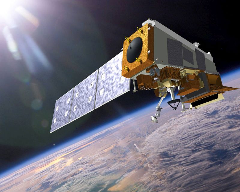
Countdown with NOAA to the launch of the next generation of polar-orbiting weather satellite scheduled for November 1, 2022. This special page features a countdown clock and dynamic and interactive graphics and imagery. These are organized into the following sections with brief textual descriptions...
Check it out HERE
[ Back to Top ]
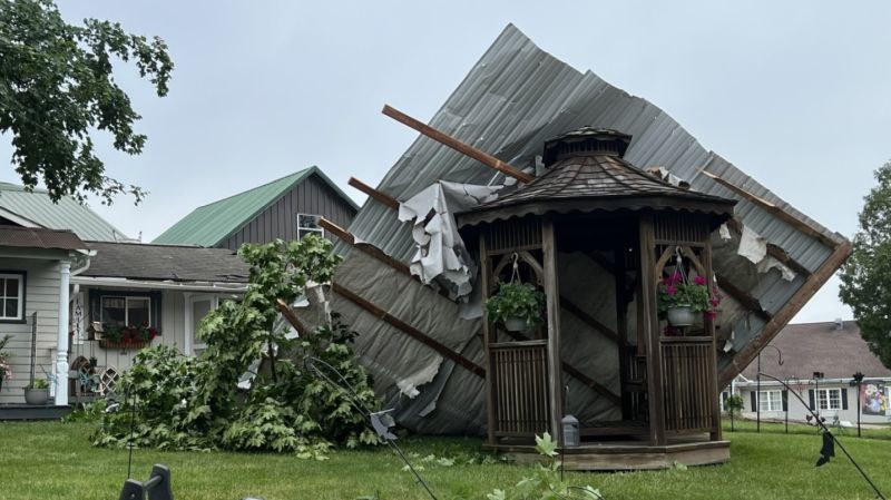
October 11, 2022
From NOAA News & Features at https://www.noaa.gov/news/ian-is-15th-billion-dollar-disaster-year-so-far
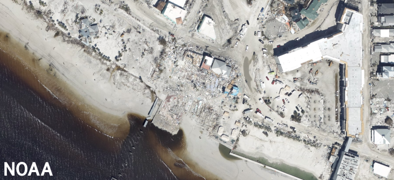
The U.S. was hit with 15 separate billion-dollar weather and climate disasters in the first nine months of the year, according to scientists from NOAA’s National Centers for Environmental Information.
Along with September 2022 being quite warm and dry, it saw an uptick in tropical activity in the Atlantic, with Hurricanes Fiona and Ian bringing devastation in their wake.
Below are highlights from NOAA’s September U.S. climate report:
For more aerial imagery of Hurricane Ian impacts, please visit https://oceanservice.noaa.gov/news/sep22/ngs-storm-imagery-ian.html
[ Back to Top ]
By Calla Cofield, NASA Jet Propulsion Laboratory
October 12, 2022
From NASA at https://www.nasa.gov/feature/jpl/star-duo-forms-fingerprint-in-space-nasa-s-webb-finds
A new image shows at least 17 dust rings created by a rare type of star and its companion locked in a celestial dance.
A new image from NASA’s James Webb Space Telescope reveals a remarkable cosmic sight: at least 17 concentric dust rings emanating from a pair of stars. Located just over 5,000 light-years from Earth, the duo is collectively known as Wolf-Rayet 140.
Each ring was created when the two stars came close together and their stellar winds (streams of gas they blow into space) met, compressing the gas and forming dust. The stars’ orbits bring them together about once every eight years; like the growth of rings of a tree’s trunk, the dust loops mark the passage of time.
[ Back to Top ]
From United Nations News at https://news.un.org/tags/remote-sensing
With COVID-19, an on-going global concern, satellite imagery can play a powerful role in tracking where we are and how we’re responding to “restrictions on movement” due to the coronavirus.
That’s according to Robert Chen, co-chair of the Thematic Research Network on Data and Statistics, known as TReNDS, who was at UN Headquarters this week to discuss his initiative, which is part of the UN Sustainable Development Solutions Network.
Instructions: Visit the site and click the play symbol to listen to the interview audio.
[ Back to Top ]
October 12, 2022
From NASA at https://www.youtube.com/watch?v=7XExmeG_LVg
The results are in from the test mission to potentially save humanity. NASA was excited when its Double Asteroid Redirection Test, or DART, mission successfully crashed a satellite into an asteroid seven million miles away from Earth. They say the impact, while small in the universe, was huge for the planet because it changed the asteroid’s trajectory. Scientists say they exceeded expectations by reducing the orbit by 32 minutes. Inside Edition Digital’s Mara Montalbano has more.
[ Back to Top ]


From NOAA Education at https://www.noaa.gov/education/back-to-school
August 17, 2022
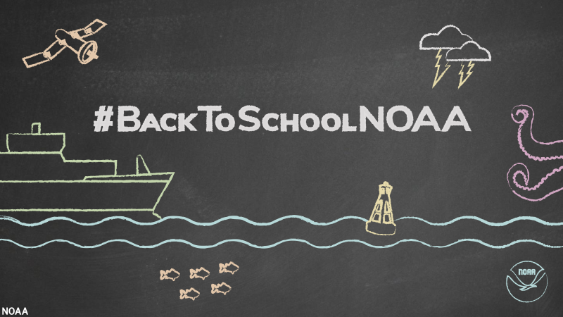
With a new school year just around the corner, teachers and educators are gearing up to create lesson plans and find engaging activities for their students. We have a tool to make it easier than ever to include NOAA resources in your classroom: NOAA Sea to Sky, a new education resource database that houses over 1,200 educational resources created by NOAA and our partners.
“As teachers are getting ready for another school season, they are looking for reliable, credible sources that are easy to find and an asset to use in their classrooms,” says Louisa Koch, NOAA’s Director of Education. “We hope this new searchable database is a tool that science teachers and educators can use for all of their teaching needs.”
Not sure where to start? We asked staff from across NOAA to share the resources they think are a must-have for the classroom this year.
Just click the Read more HERE link below to...
[ Back to Top ]
From NOAA Education at https://www.noaa.gov/education/NOAA-spooky-science
October 12, 2022
October is spooky season! Follow along with us as we celebrate all things spooky, odd, and spine-tingling in the ocean and atmosphere with NOAA Spooky Science!
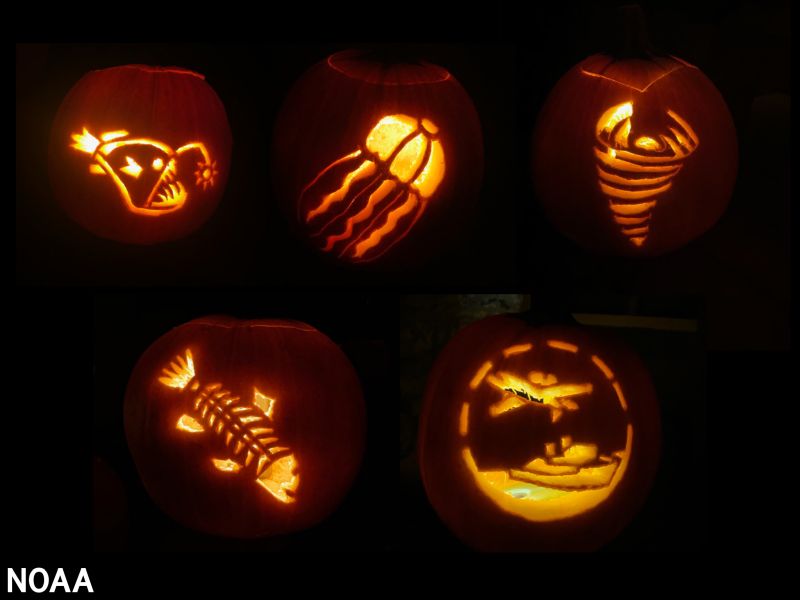
Use this chilling, creepy content in your classrooms and institutions, or with your loved ones at home!
"We especially liked the giant squid tangling with the NOAA submersible!"
[ Back to Top ]


How big does an antenna have to be to receive weather satellite signals? Some are very large and some are very small. Is there a "right" size, and if so, what is it? In this activity, learners design and build a scale model antenna of the type needed to receive weather satellite signals and make the connection between wavelength, frequency, the speed of light, and the size of the antenna. They use the connection to determine the size of each antenna element, then build a 1/10 scale model of the real antenna.
| Grade Level: | 9-12 |
| Time Requirement: | 1-2 class periods |
| Prerequisites: | EMR spectrum; wave properties; grade-level math |
| Relevant Disciplines: | Physical Sciences, Engineering & Technology |
[ Back to Top ]
Share your satellite-based lesson ideas with the teaching community.
Send us a full lesson plan, or simply suggest a lesson idea. If you found the idea online, please share the source as well. The lesson can be about anything that helps connect learners with satellite-based technology - any grade level K-12 - any STEM subject area or geography.
"Satellite-technology" includes any part of the science, math, engineering, or technology of satellites, rockets, and remote sensing instruments as well as the use of any environmental satellite data to explore questions related to aspects of global change and local impacts in the long term, short term, and catastrophic time frames. Of special interest are lessons providing opportunities for learners to inquire, experiment, and apply mathematics.
Perhaps you designed a lesson yourself - we will happily prepare it for future publication in More Lessons from the Sky and inclusion in the SEA Lesson Plan Library. Perhaps you found a worthy lesson plan published elsewhere - we can research it inclusion in a lesson plan spotlight. In either case, you will receive full credit for developing and/or bringing the lesson to the attention of the teaching community. Don't forget to share your insights if you tried the lesson with students.
Please share your ideas at SEA.Lessons@SatEd.org.
[ Back to Top ]

![]()

This edition of the SEA Newsletter was produced in HTML5.
It is best viewed with most recent updates of Firefox, Edge, Chrome, Opera, or Safari.
©Satellite Educators Association, Inc. https://SatEd.org SEA.Newsletter@SatEd.org
Satellite Educators Association, Inc. is a 501(c)(3) non-profit educational organization.
The SEA Newsletter is published on-line monthly except January and August and available at no cost.
SEA terms, conditions, policies, and contact information are detailed HERE.
Unless otherwise listed, all photo and image credits are the authors of the articles.
Any opinons expressed in this Newsletter are those of the authors
and not necessarily those of the Satellite Educators Association, Inc.
or any of its officers, members, or representatives.
Many SEA Newsletter items contain third-party links to sites not governed by Satellite
Educators Association, Inc. The viewer is cautioned to be aware of the terms of use and
privacy policies for those third-party sites.
![]()